Balancing and Optimization of Multifunctional Use of Juniper Forests in Central Asia (JuniperCA)
The Pamir-Alay mountain system is a worldwide hotspot of biodiversity where juniper forest ecosystems play a significant role. The use of firewood and degradation by pastoral practices prevent successful reforestation and jeopardize their survival, aggravated by drought stress attributed to climate change. To protect these forests, a more comprehensive study of their ecology and growth conditions was conducted to develop integrated strategies that combine protection and sustainable use of juniper forests. This project, implemented by the Institute of Landscape Planning and Ecology (ILPÖ) and University of Applied Sciences for Sustainable Development Eberswalde (HNEE) jointly with MSRI, aimed to improve the capacity of forest administrations in Tajikistan and Kyrgyzstan, as well as local stakeholders, enabling actors to sustainably use and preserve juniper forest ecosystems. The project used a simulation approach to demonstrate the consequences of alternate behavior and strategies and relied on the efficiency of transdisciplinary and transboundary knowledge transfer.
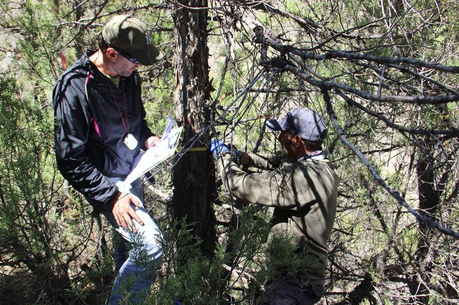
Satellite imagery was used to derive horizontal and vertical parameters of juniper stands for estimating biomass and volume, as well as the spatial distribution of juniper forests in the Pasrud catchment, northern Tajikistan. Juniper data from plots were collected to build regression models to estimate above-ground biomass and volume and model the state of Juniper forests using spectral, textural, and vegetation indices derived from high-resolution satellite imagery. To estimate the stand vertical structure, ground control points are established in the field using high-precision GPS technology.
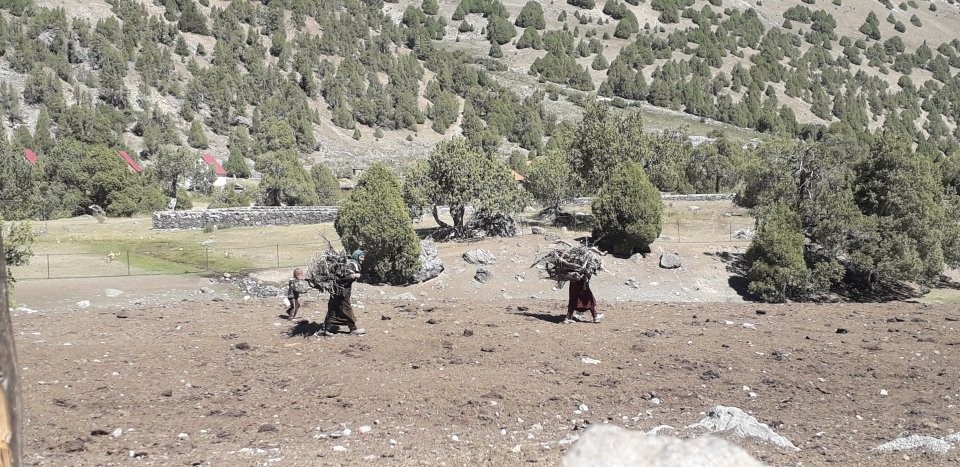
The socio-ecological component of the project aimed to understand formal and informal juniper forest use rights, practices, and estimation of wood demands in the Pasrud catchment. Interviews with villagers together with participatory and on-site observations were conducted at pasture camps. Collected data facilitates estimates of total demands for juniper wood, understanding of wood harvest practices, and the organization of juniper collection to both temporal and spatial extents. Similar to pasture interviews, systematic interviews of households and observations were conducted in selected villages of the Pasrud catchment to estimate the role that juniper plays in livelihoods and how much energy this wood comprises. Aside from household surveys, historical changes in forest and pasture management, energy prices, and cultural aspects of using juniper were discussed in open key informant interviews. These data are used to identify the amount and spatial extent of juniper harvesting in the catchment.